In the local dialect it means “people’s land”. In my own southern dialect, it means “life changing”. Formerly known as the Queen Charlotte Islands, Haida Gwaii is an archipelago of islands almost a hundred nautical miles west of Prince Rupert, British Columbia. Way the fuck up there. From the northern most island, you can see Alaska, 30 miles north. As I said…..
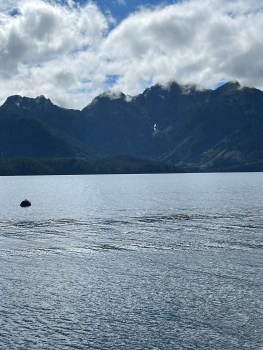
It’s been a life long dream to paddle there and it should be for anyone who’s ever dipped a paddle in the water. Countless miles of shoreline, oceanic life forms that reach out and touch you. A thousand year old growth forests so thick and dark, you’re displaced 20 feet into them. It makes the Pacific Northwest of the US seem like Central Park.
We started the journey with an eight hour ferry ride to D’jian Giits, the port town on the North island. The only way to this magical place is obviously by water or air; and not much else once you get there. We camped and paddled for a week meeting some incredibly gracious and warm locals, all of whom were curious about us and our trip. Don’t get me wrong, modern life has moved in. I was chatting with one native local and noticed he had an Apple Watch on his very tattooed wrist.
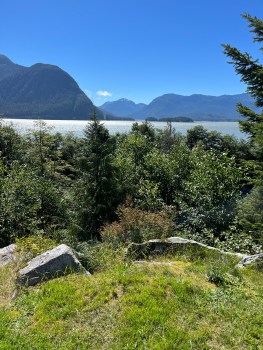
We figured the best way to visit the Gwaii Hanaas National Park in the south the first time was with a guided sea kayak trip. Turns out it was one of the best trips of my life and I always prided myself by figuring things out in the woods alone.
The eight day paddle through Gwaii Haanas National Park was beyond anything I’ve ever experienced on the water. I could expound forever about the intimacy and beauty but the best way to do this is on your own time and read the book The Golden Spruce. It’s a well written story about the area, it’s history and it’s people. Worth the read.


Got something to say? Lemeno.